Sunday, April 25, 2010
Severe Wx Moving Out
Had some incredible severe weather over south eastern KY. The worst of it is moving out and now we're left with scattered showers and gusty winds until the cold front passes. I hope you enjoyed the severe weather coverage today. I'm worn out after it so to bed with me. Take care until next time!
Saturday, April 24, 2010
Live Severe Weather Blog 2 PM
15 
Latest local radar from Accuweather:
6:15 Update: Blog going live at 7:30 to track severe weather as it moves into eastern KY. Radar starting to act up a bit again but hopefully it will be worked out as we move into the evening.
4:15 PM Update: I'm hoping the rain we're seeing will help lessen the severe threat for later. However have to keep an eye out now for flash flooding.
2:00 PM Update: Live blog going to be postponed till we actually have severe weather in the area. Still having some issues with my GR Level 3 Radar updating. I will be posting here, on twitter @wxmanshane, and at Chris Bailey's weather blog (Link on the left hand side.)
1:35: Looks like a violent tornado rolled through the town of Yazoo, MS. Trained spotters on the ground reporting EF-4 damage. 1st line of showers moving into south eastern KY right now. These could have some gusty winds and lightning with them.
1:00 Update: Radar streams of level 3 data (What I use for my Radar stream) is overloaded. The last image to come in is almost 50 minutes old now. Also The Weather Channel reports of 30 homes being destroyed in Eagle Bend, Mississippi. Major tornado likely heading towards Yahoo City, MS.
12:50 Update: High Risk zone from SPC has been expanded to include portions of south central and western KY. Tornado Watch for that area coming soon.
Hey everyone, looks like severe weather will be heading our way later today. I'm going ahead and getting everything set up for a Live Severe Weather Blog to start at 2 PM. If the severe weather is not in our area by that point it will be pushed back but I wanted to go ahead and get everything set up and ready.
Live Broadcasting by Ustream
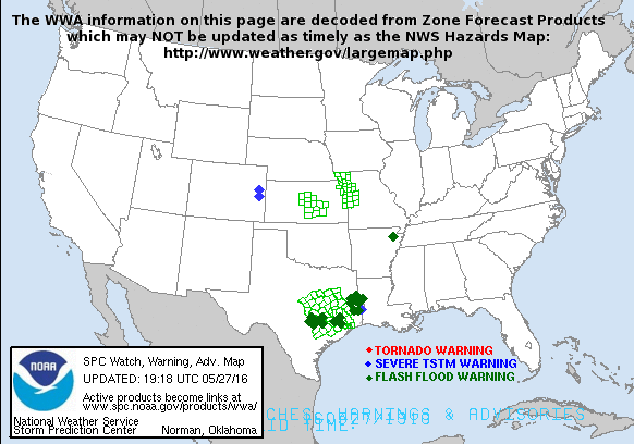
You can see live updating radar in the top box. I'm going to leave the latest from SPC down below:


Friday, April 23, 2010
Severe Weather Possible Saturday
Hey everyone! I'm back with my thoughts on the potential for severe weather this weekend.
Thoughts outside of the video and summary:
*I think south eastern KY will see a few severe thunderstorms tomorrow. The majority of torandic activity stays west of us tomorrow, but not going to rule out a few storms going tornadic tomorrow.
*The main threats will be damaging winds, large hail, intense lightning and heavy rain.
*Some minor urban and stream flooding will be possible as we could see some heavy rains add up by Sunday morning. Here's HPC's thoughts on potential rainfall through Monday morning. However we need to rain, London is 4.66"s behind where it should be this time of year as of this morning.
 My thoughts on the timeline of events:
*A few stray showers and thunderstorms are possible over night tonight and early Saturday morning.
*By mid morning we catch a break in the action and will likely see some sunshine into early afternoon.
*By early afternoon *Say after 2 PM* we could see a few stray storms fire, these will have the best chance to produce large hail and tornadoes.
*Depending on how many of these stray showers pop will determine a bit of the impact of the main line of storms which moves through in the evening hours *Say after 6:30-7:00 PM*
*The line of storms moving through will drop heavy rain, have strong winds, lots of lightning and could spin up an isolated short lived twister.
I will take the blog live tomorrow afternoon here via Ustream with live up to the minute radar with analysis from me on any severe storms that enter Laurel or the surrounding counties. I will also have a chat going where you can ask questions and I'll answer. Until then keep an eye on the skies and turn those weather radios on. Take care!
Subscribe to:
Comments (Atom)


