Saturday, February 28, 2009

Snow Update *And Possible Flooding*

FLOODING CONCERN UPDATE, 1:30:


Hey folks just a quick update before I head into work. I'm hearing reports of over a half inch of rain in some parts of the area *Thanks Andy and Michael S*. Doppler Radar has shown estimates as much as 2 inches of rain in some parts of the area so far.


If we continue to see heavy rain before the change over to snow some isolated flooding, especially in flood prone areas is possible. Luckily for us we have been relatively dry lately so the ground should be able to soak most of this in. However ponding of water on the roads is possible, so be careful out there while driving. And keep an eye on those creeks. Back to your regularly scheduled post.

*ORIGINAL POST*

Good Saturday everyone, hope you are enjoying your weekend. No new 5-day right now, we've got more important matters to deal with. Things look on track for a pretty good snowstorm for most of southeastern KY. National Weather Service in Jackson has issued a winter weather advisory for all of southeastern KY until Sunday Morning *Which I suspect might be extended past that*. NWS is expecting a general one to three inches, and perhaps some freezing rain which could cause slick travel conditions.


So let's set the playing field for those of you just joining us to find out what's going on.


We have an area of low pressure off to our south east which is responsible for our rain this morning. As it continues to work off to the east it's going to suck in more cold air and turn our precip over to snow. Behind it to our west we have an upper level disturbance moving to the south and east. This is what should bring us our snow. Depending on it's track will determine how much snow we will see, as well as if any of our current precip is turned over to snow. Also a lot of that precip in central KY isn't reaching the ground yet because of the dry air in place at the surface (IE Verga).

Here's a look at Temps and the freezing line as of noon.


That line should continue to push farther tho the south as the day progresses. So how much snow do I think we're going to see?


Map is pretty self explanatory. I hope this right because I'm not going to have a chance to work on it during the day.

Here's all you need to keep ahead of the game today.

Local Radar:


Radar to watch the Upper Level Low:


KY Mesonet Temperatures:


Both Radars are from the fine folks at Intellicast. I'll have enough update after midnight tonight. Stay safe out there and hopefully you get as much snow as you want to see!

Friday, February 27, 2009

Weekend Snow?

Your 5-day Forecast for London KY:

Saturday: Chance of Rain Changing to Snow late. High of of 42, Low of 30

Sunday: Chance of Snow, otherwise Mostly Cloudy. High 34, Low of 22.

Monday: Chane of Scattered Snow Showers, otherwise Mostly Cloudy. High of 26, Low of 17.

Tuesday: Partly Cloudy. High of 35, Low of 18.

Wednesday: Mostly Sunny. High of 38, Low of 20

Forecast Discussion:

Okay here's the break down. The models are all over the place. Some are taking the storm down to the gulf coast and then up the Atlantic coast. Others are taking a more inland route. The exact track of the low pressure is going to determine exactly what we see, and more importantly how much snow we see. There is still a lot of uncertainty in the track of the storm, so with that said I'm going show a map of where I think the low is going to go, followed by how much snow that would mean for KY.

Track:


Assuming This track is correct, this is what I would expect for totals.


As you can see there will be a very sharp cut off in who gets snow and who doesn't get much at all. I will have a more detailed totals map tomorrow, but at this point it's an effort in futility to go more specific just because the models will continue to bounce around a bit.

Wednesday, February 25, 2009

Wednesday Quickie

Hey Folks,

I don't have a lot of time tonight so, quick look at your 5 day with some discussion mixed in.

5-day Forecast:

Thursday:

Showers and Thunderstorms likely, some could be strong to severe. Low of 45, Hi of 63.

Friday:

Showers and Thunderstorms continue early, otherwise mostly cloudy. High early in the day of 59, Low of 43.

Here's where the forecast gets really tricky:

Saturday: Chance of Wintry mix, High of of 42, Low of 28.

Sunday: Chance of Snow, otherwise Mostly Cloudy. High 34, Low of 23.

Monday: Chane of Snow, otherwise Mostly Cloudy. High of 26, Low of 19.

Okay since I'm low on time don't have time to post the models... but that's okay because every one is saying something different besides the European and the Canadian. They are saying big snow storm. Do I buy that just yet? No Way!

Is the possibility of a big snow storm on the table, oh you better believe it.. but so is the possibility of an ice storm, all rain, flurries, clouds, and about everything in between. This is the lowest confidence forecast I've ever put together. I would fill just as confident as rolling a dice, throwing darts, flipping a coin or even ASKING A MAGIC 8 BALL about this forecast. So just hang with us folks... I hope to have more answers for you tomorrow night or Friday morning.

So I asked the 8-ball... "Will we see a big snowstorm this weekend?"
Here's what it said:


....

Monday, February 23, 2009

Monday Update

Your 5-day Forecast:


Tuesday: Sunny, Low of 17, High of 44.

Wednesday: A Slight Chance of Showers and Thunderstorms, otherwise Partly Cloudy. Low of 29, High of 54.

Thursday: Once again a chance of Showers and Thunderstorms, otherwise Partly Cloudy. Low of 42, High of 63.

Friday: Showers and Thunderstorms Likely, high winds are possible. Low of 42, High of 63.

Saturday: Looks likes a chance of Rain changing to snow is on tap. Low of 28, High of 40.

Forecast Discussion: Well the first part of the week is looking calm. However we could be in for a wild ride come Friday into Saturday. The Euro is trying to throw together a big time winter storm in time for the beginning of next week.


The GFS Is showing something similar.

So you're saying hold up, that thing is off to our Southeast. Your right it is. But knowing model trends it could head back to the northwest. Also even if we don't get the storm that would be some serious cold air in the area. Also it might be a non event as several other possible systesm this winter. It's something we'll keep an eye on the next couple of days.

Sunday, February 22, 2009

Sunday Morning Snow Recap

Your 5-Day Forecast for London, KY:


Monday: Partly Sunny. Low of 14, High of 28.

Tuesday: Sunny, Low of 16, High of 40.

Wednesday: A Slight Chance of Showers and Thunderstorms, otherwise Partly Cloudy. Low of 27, High of 52.

Thursday: Once again a chance of Showers and Thunderstorms, otherwise Partly Cloudy. Low of 40, High of 60.

Friday: Showers and Thunderstorms Likely, high winds are possible. Low of 32, High of 63.

Forecast Discussion:

So we ended up getting about an inch or two across the region so I feel good about my forecast. It was quite incredible to see temperatures surge up ahead of the front and still put down a decent little snow.

Here's whats on tap for the rest of the week, well the first half of the week is looking pretty nice, and warmer once we get past a cold Monday. High pressure will be in command until Wednesday, when a warm front starts to move north across the state, and could bring us a chance of some scattered showers or storms on Wednesday and a better chance on Thursday.

The best chance for showers and storms is on Friday when the cold front and low pressure actually passes through the state.

GFS Friday:


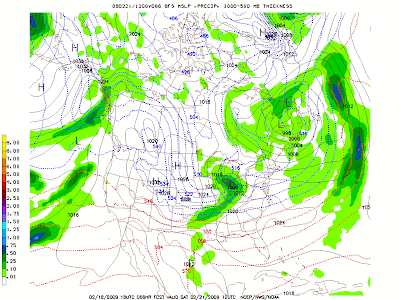
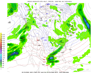
As you can see this run of the GFS is trying to get a bit of a squall line forming on the front. This would make sense as temperatures ahead of the front would be in the 60s and behind it in the 30s. This could potentially be a strong wind situation so I'll be keeping an eye on it throughout the week. After that we cool back down and then look to warm back up in the middle of the week after next.

It looks like to me that March is going to be a pretty active month with at least the potential of having one or two more accumulating snowfalls. We still might be able to crank out a big one as the NAO is trending back to Negative, and the PNA to positive. We'll just have to wait and see.

Have a great day and we'll have an update for you tomorrow.

Saturday, February 21, 2009

Saturday 5-Day

Your 5-Day Forecast for London, KY:

Sunday: Snow showers early, otherwise Partly Sunny. Low 0f 17, High of 28.

Monday: Partly Sunny. Low of 16, High of 32.

Tuesday: Sunny, Low of 18, High of 40.

Wednesday: A Slight Chance of Showers and Thunderstorms, otherwise Partly Cloudy. Low of 28, High of 52.

Thursday: Once again a slight chance of Showers and Thunderstorms, otherwise Partly Cloudy. Low of 40, High of 60.


I still think an inch or two of snow is possible in London tonight. We'll just have to wait and see. Use the Gadgets on the page to track the current weather conditions.

Saturday AM Update

Hey folks,

Just a quick update this morning. Looks like the rain is moving in faster than I expected. It also appears that the cold air is not mixing in very fast, so this could lead to an extended period of rain. Keep an eye on the temperatures in the mesonet gadget and radar at the bottom of the page. I still think a general 1-3 inches on tap for most of the area. I'll have a quick update to your 5 day *No Graphics* Tonight.

Update: Winter Weather Advisory posted for most of Eastern KY, 1-2 inches of snow generally expected with some locally higher amounts, mainly in the higher elevations of eastern KY. This runs until Midnight Tomorrow.

Friday, February 20, 2009

Welcome to the Weekend

Your 5-day Forecast for London, KY:


Saturday: Rain changing to Snow is possible from a clipper system moving in. Partly cloudy becoming mostly cloudy before the precip starts. Low of 26, High of 53.

Sunday: Snow showers early, otherwise Partly Sunny. Low 0f 19, High of 28.

Monday: Partly Sunny. Low of 14, High of 31.

Tuesday: Sunny, Low of 16, High of 40.

Wednesday: A Chance of Showers and Thunderstorms, otherwise Mostly Cloudy. Low of 33, High of 46.

Forecast Discussion:

Things look pretty simple compared to how they were looking. We could see an inch or two in the London area by Sunday morning. Maybe an isolated 3 Inch snowfall is possible but I'm leaning against it. After that things are looking cooler, but Sunny for the first part of the week. Business picks up towards the end of the week though as we'll have a chance of showers and thunderstorms on Wednesday. I'll have an updated 5-day tomorrow.

Thursday, February 19, 2009

Thursday Quick Post

A quick 5-day Forecast:

Friday: Mostly Sunny and Cold. Low of 16, High of 34.

Saturday: Rain changing to Snow is possible from a clipper system moving in. Low of 26, High of 45.

Sunday: Snow showers early, otherwise Partly Sunny. Low 0f 19, High of 28.

Monday: Partly Cloudy with a slight chance of Snow. Low of 13, High of 33.

Tuesday: Sunny, Low of 23, High of 42.


The models are really backing off our snow chances. A general 1-2"s across the state is what they're showing now. Things are likely to shift again before this storm hits, however it looks like it's going to be a case of Warm Air Advection winning again. I'm filling in tomorrow morning so that's all I can do because I need to try to get to sleep in about a half hour. I'll have a big update tomorrow afternoon.

Wednesday, February 18, 2009

Wed PM Update

Your 5-day Forecast for London KY


Thursday: Rain changing to some light snow. Just after midnight High of 56, Low of 22. I want to note that low is not a morning low, it will likely happen just before midnight Friday.

Friday: Mostly Sunny and Cold. Low of 15, High of 33.

Saturday:A little rain changing to Snow is possible from a clipper system moving in. Low of 26, High of 39.

Sunday: Snow showers early, otherwise Partly Sunny. Low 0f 17, High of 28.

Monday: Partly Cloudy with a slight chance of Snow. Low of 10, High of 33.


Forecast Review:Wednesday: Showers, and maybe even a Thunderstorm is likely. Winds will be gusty. Low of 44, High of 58. To be updated Later with actual data.


Forecast Discussion: Okay boys and girls, things are looking pretty interesting for this weekend. It has my attention in a serious manner. Let's get to the good stuff after we do a little house cleaning. I want to apologize for not mentioning the chance of severe weather today. I honestly though the brunt of it was going to stay south of the region, but sure enough we got just enough instability to trigger off some impressive looking storms on Radar. I haven't heard much in the way of damage reports, but I do feel bad not giving you a heads up even on the slight possibility. I'll do better next time.

Okay, slight chance of snow tomorrow as we get some wrap around from the low pressure moving out, we might get a dusting, but the ground is so warm it's probably not going to happen. So lets move on to the fun and games.

A fairly decent looking clipper system is set to move in the Bluegrass State Saturday morning, and with it bringing us a chance at a good late season snow. Let's see what the models are showing:

GFS:

Sat. Morning:


Sat. Afternoon:


Sat Night:

It's showing a little bit of rain, changing over to all snow in a hurry, and really dropping some heavy precip for a clipper. The reason is that it's feeding off a developing low pressure in the gulf coast. If it can suck the moisture off that system, and mix it with it's cold air and upper level energy *Oh which there is plenty*, it would be game on for a decent snow. The Canadian and NAM/DGEX are both on board.

Canadian: Sat Morning:


Sat Afternoon:

Sat Night:


NAM/DGEX

Sat Morning:


Sat Afternoon:

Sat Night:


Sun Early Morning:


Okay so the big thing to notice with these two models is that they're really trying to kick that moisture from the south into our clipper. If this happens it is game on for a big snow somewhere in the TN and Ohio River Valleys. Here's what the latest models are showing for totals:

NAM:


GFS:


As you can see the NAM is really blowing up some heavy snows in TN and Southern KY. Also realize that only goes out 84 hours, so you continue to move that heavy snow band east and London could get caught in it. So the moment you've waited for, my first call map for the snow!


Okay let me explain this cause it's a bit different than normal. If you're north of the white line you'll probably see 1-3"s. If your between the White and and Blue line a General 2-4" is on tap right now. If you're south of the Blue line you should see more than 3"s. Now here's what the colors are for... that's where I think the heavy snow band is going to set up. The area that gets caught in the heavy snow band IF IT SETS UP, will see more than 5"s of snow. This is going to be a serious case of 40 miles will make all the difference with this storm. I will continue to update this map over the coming days on where I think the snow band will set up, and adjust the snow totals accordingly. Once again this is just a first call and will be adjust several times over the coming days.

So there ya have it! I'm going to be keeping my eye on this and I'll have another update tomorrow. It will not be very long because I have to fill in Friday morning, however I should have a massive update around 2 PM on Friday. Take care and enjoy the Sunny skies tomorrow, it might be a few days before we see it again without some snow :P

Mobile Update

Severe weather is on going in SE KY right now. Check out warnings in the left and radar at the bottom. Update coming later.

Update: Just got back from work, looks like the worst of the storms are over. Highs are going to bust by 7 degrees at least cause of the warm sector the storm pulling into southern KY. I'll have a full update after I get a chance to look at the latest data and eat some dinner.

Wed AM Quick Update

Good morning folks, just a quick update before I head into work.

1. Showers continue to work their way across the region. We're already in the low 40's this morning. Our Low and cold front is still up to the northwest and should work through tomorrow morning. Highs today should hit the mid to upper 50's.

2. I still think a little wrap around snow is possible tomorrow morning. Minor accumulations possible as mentioned in Tuesday's map, but probably won't get up to 2"s.

3. Our system for Saturday is still on track to bring mainly snow, with just a touch of rain possibly mixed in Saturday morning.

4. The weather models are at war this morning about whether or not we'll see this big storm that Euro and Canadian are showing. GFS is saying no. I'll have more details tonight.

We'll have an updated graphical 5-day and maybe a video blog if I have time tonight, if not you'll at least get an update discussion. Take care and you can track the rain and temperature with new gadgets on the left side and bottom of the price.

Tuesday, February 17, 2009

Tuesday Night Update

Quick Update as the Cats are Tipping off:

A snowfall totals map through Friday morning.

As you can see east of I-64 could see a dusting, maybe a little more. I'm not expecting much out this first clipper. Our 2nd clipper is going to be interesting, and what comes behind it even more interesting.

Here's the NAM's thought on the first clipper:


As you can see we don't drop below freezing till early Thursday morning, so this would be mainly rain tomorrow, followed by some light snow. If we do get any accumulation out of this it will be light, and it will mainly be on the grassy areas and rooftops. Might have to watch out for some black ice on bridges and overpasses as you got to work or school Thursday morning.

Next our Weekend clipper, let's see what the GFS is showing for it:

Sat Early Morning:
Sat Late Morning:

Sat Afternoon:
So the GFS is showing we might start it out as a little mix or rain before quickly changing over to all snow, and likely putting down some accumulating snow. It's also supported by the 0z NAM which just finished running. I'll have a call map tomorrow on how much. Now here's where things get interesting, the European and Canadian are trying to develop a southern storm in the wake of this clipper.

Canadian:

Sunday Morning:


Sunday PM

I think it may be moving things in just a bit too fast, which is why I went party sunny on my 5-day from earlier in the day. The timing will be critical on this, and we'll have to see how the 0z GFS trends to see if this idea has any credit. It's on the radar but it's too far out to get excited just yet... but this might be a system that sneaks up on us. Thanks for stop by the blog today, I hope you like the new layout and color scheme. I'm going to continue fine tuning things over the next couple of days, as well as fine tuning this forecast. So come back and see us soon, and be sure to tell your friends about us. Have a great day!

Oh and BTW, check out this new service from the NWS. It's called iNWS and it will send you mobile e-mail and/or text message alerts about severe weather.

Radar to Track tomorrows rain:

Something I've been working on

Your 5-Day Forecast for London KY:

Wednesday: Showers, and maybe even a Thunderstorm is likely. Winds will be gusty. Low of 44, High of 58.

Thursday: Rain changing to snow. Just after midnight High of 51, Low of 22.

Friday: Mostly Sunny and Cold. Low of 17, High of 34.

Saturday: Rain changing to Snow is possible from a clipper system moving in. Low of 26, High of 37.

Sunday: A few flurries early, otherwise Sunny. Low 0f 17, High of 26.

And now in graphical form:


Long Range Discussion:

Not much to change from yesterday besides the fact that Warm Air Advection looks to work in ahead of our Saturday clipper, which will change it to a little rain to begin with. Sorry for all you snow lovers :(.

Website Talk: So I hope you like the graphical 5-day, it's something I built today messing around in Artweaver. Let me know what you like about it, dislike, etc. Over the next couple of weeks based on your feedback going to change the blog a bit. What I want to do is be able to make some simple maps in Google Earth, with nice labels and legends made in Artweaver to be able to do a quick forecast discussion. And I'll save the more technical stuff for video blogs using model data. I'm also looking at changing the format of the blog to always have updated radar, satellite, and 5-day forecast at the bottom of the page. Also looking into changing the color scheme and layout of the blog to match the graphics I'm making. It's going to be a long drawn out process, but I hope it'll make the blog a bit more appealing to you guys, and make things a bit easier to follow. Feedback is critical for this, so please leave some in the comments section.

Forecast Review: Tuesday: Sunny with increasing clouds later in the day. Low of 21 and a high of 45. Actual: 18/51. Little surprised the high got up to 51, But the clouds didn't build in as fast as I thought they would, and once again I underestimated WAA... need to stop doing that *sigh* .

Tuesday Noon Update

Looks like our rain showers are going to be moving in a little faster than I expected with my update yesterday. Looks like now we could see rain in London by as early as tonight. Here's a Radar for you to track where the rain is.


I'll have a full update including 5-day Forecast, and Long Range discussion later in the day.
Also I'm going to be working on the site a bit a today so if things change a little don't be scared, just seeing if I can adjust this thing a bit more to my liking.

Monday, February 16, 2009

2000 Hits!

Before we get to the 5-day forecast, I just want to thank everyone for stopping by the blog: We hit a milestone yesterday... 2000 hits to the blog. I've been tracking traffic on the site since Jan. 25, and in less than one month we've had over 2000 visits, so thank you for taking time and stopping by. Please be sure to tell your friends about us and promote the blog. Back to your regularly scheduled 5-day :P.

Your 5-day Forecast for London, KY:

Tuesday: Sunny with increasing clouds later in the day. Low of 21 and a high of 45. (Lowered a few degrees, thanks for the advice Andy.)

Wednesday: Rain is likely. Low of 37, High of 58.

Thursday: Rain changing to snow, Just after midnight High of 53, Low of 26.

Friday: Partly Cloudy and Cold. Low of 22, High of 33.

Saturday: Snow is possible from a clipper system moving in. Low of 19, High of 32.


Forecast Review:

Monday: Much Cooler, and partly cloudy, with a slight chance of snow. Low of 26, High of 39.

Actual: 24/40 : Not bad so far, shouldn't see the temp get much higher than this so I feel good with yesterdays forecast.

Forecast Discussion:

Video Time!


I'm still trying to find the best way to upload these, so bare with me.

The quick and dirty of the video is that we're going to see a lot of rain and a little snow Wed/Thu, and then could see some decent snow for the weekend. Once again thanks for stopping by, and thanks again for the 2000 hits!

Sunday Late Update

Monday: Much Cooler, and partly cloudy, with a slight chance of snow. Low of 26, High of 39.

Tuesday: Sunny with increasing clouds later in the day. Low of 26 and a high of 45.

Wednesday: Rain is likely. Low of 37, High of 58.

Thursday: Rain changing to snow, Just after midnight High of 53, Low of 26.

Friday: Partly Cloudy and Cold. Low of 22, High of 33.

Sorry folks, that's all for today, still not feeling great.

Saturday, February 14, 2009

Long Range Discussion

Title of the post says it all, let's talk about the period of the forecast that looks pretty interesting.
And that would be our Wednesday/Thursday storm system. It would appear that right now it's looking like mainly a rain event for London KY. Let's take a look at some of the models

GFS:


GGEM Ensembles:


NAM:


As you can see they're all jumping on a northern track for us, which would mean rain changing to some snow. Highest accumulations would be in the mountains of eastern KY.


Looks like after that we are going much colder, and our next best chance of snow after that would be a clipper system for next weekend.


We'll see how this system develops, clippers usually don't drop much snow around here, but it will be cold enough that this one could be an over achiever.

Teleconnections:

Just a quick show of the NAO and PNA:


For us to get a big winter storm around here, we need a positive PNA, and a negative NAO typically. As you can see we're getting the opposite in the forecast, with an extreme negative PNA and a weak positive NAO. This would suggest a wetter than normal, and slightly warmer than normal pattern setting in for the new couple of weeks.

So there ya have it, have a great day and we'll talk again tomorrow.