Thursday: Rain changing to some light snow. Just after midnight High of 56, Low of 22. I want to note that low is not a morning low, it will likely happen just before midnight Friday.
Friday: Mostly Sunny and Cold. Low of 15, High of 33.
Saturday:A little rain changing to Snow is possible from a clipper system moving in. Low of 26, High of 39.
Sunday: Snow showers early, otherwise Partly Sunny. Low 0f 17, High of 28.
Monday: Partly Cloudy with a slight chance of Snow. Low of 10, High of 33.
Forecast Review:Wednesday: Showers, and maybe even a Thunderstorm is likely. Winds will be gusty. Low of 44, High of 58. To be updated Later with actual data.
Forecast Discussion: Okay boys and girls, things are looking pretty interesting for this weekend. It has my attention in a serious manner. Let's get to the good stuff after we do a little house cleaning. I want to apologize for not mentioning the chance of severe weather today. I honestly though the brunt of it was going to stay south of the region, but sure enough we got just enough instability to trigger off some impressive looking storms on Radar. I haven't heard much in the way of damage reports, but I do feel bad not giving you a heads up even on the slight possibility. I'll do better next time.
Okay, slight chance of snow tomorrow as we get some wrap around from the low pressure moving out, we might get a dusting, but the ground is so warm it's probably not going to happen. So lets move on to the fun and games.
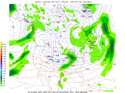
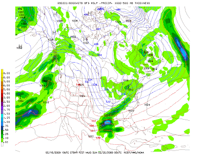
A fairly decent looking clipper system is set to move in the Bluegrass State Saturday morning, and with it bringing us a chance at a good late season snow. Let's see what the models are showing:
GFS:
Sat. Morning:

Sat. Afternoon:

Sat Night:

It's showing a little bit of rain, changing over to all snow in a hurry, and really dropping some heavy precip for a clipper. The reason is that it's feeding off a developing low pressure in the gulf coast. If it can suck the moisture off that system, and mix it with it's cold air and upper level energy *Oh which there is plenty*, it would be game on for a decent snow. The Canadian and NAM/DGEX are both on board.
Canadian: Sat Morning:

Sat Afternoon:
 Sat Night:
NAM/DGEX
Sat Morning:

Sat Afternoon:

Sat Night:

Sun Early Morning:

Okay so the big thing to notice with these two models is that they're really trying to kick that moisture from the south into our clipper. If this happens it is game on for a big snow somewhere in the TN and Ohio River Valleys. Here's what the latest models are showing for totals:
NAM:

GFS:

As you can see the NAM is really blowing up some heavy snows in TN and Southern KY. Also realize that only goes out 84 hours, so you continue to move that heavy snow band east and London could get caught in it. So the moment you've waited for, my first call map for the snow!

Okay let me explain this cause it's a bit different than normal. If you're north of the white line you'll probably see 1-3"s. If your between the White and and Blue line a General 2-4" is on tap right now. If you're south of the Blue line you should see more than 3"s. Now here's what the colors are for... that's where I think the heavy snow band is going to set up. The area that gets caught in the heavy snow band IF IT SETS UP, will see more than 5"s of snow. This is going to be a serious case of 40 miles will make all the difference with this storm. I will continue to update this map over the coming days on where I think the snow band will set up, and adjust the snow totals accordingly. Once again this is just a first call and will be adjust several times over the coming days.
So there ya have it! I'm going to be keeping my eye on this and I'll have another update tomorrow. It will not be very long because I have to fill in Friday morning, however I should have a massive update around 2 PM on Friday. Take care and enjoy the Sunny skies tomorrow, it might be a few days before we see it again without some snow :P


1 comment:
Great Post Shane. I hope to see some snow in Somerset this weekend..this maybe our best shot all winter...but its still way early..so I won't get excited until around Friday night...lol
Post a Comment