Aye yi yi yi yi.... Oi.... okay enough with the phonetic noises, on to your 5 day forecast:
Sunday: Sunny with a high near 56 and low of 32.
Monday: Start the day as Partly Cloudy, clouds increase and we could end the day with rain changing to snow. High of 46 Low of 30.
Tuesday: Snow is Likely, possibly heavy snow and temperatures will fall throughout the day. High of 25, Low of 18.
Wednesday: Wrap around snow from our Winter system is still possible, so going for a chance of scattered snow showers with a High of 23, and a low of 17.
Thursday:Mostly Sunny with a Low of 19 and a High of 34.
Forecast Review from Today: 15/40 Actual: 17/44 Okay not too bad today but not great, would've liked to have been closer to the high but felt good about the low.
Forecast Discussion: Tomorrow is looking great folks, Superbowl Sunday is going to be a treat so get out and enjoy it, maybe go on a Sunday Jog before the big game to enjoy the unseasonably warm temperatures we will see tomorrow.
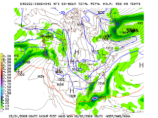
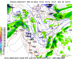
Now onto the zombie big daddy storm. This thing was dead to us, out to sea, good bye, so long, we were not going to see much from it... and then the 0z models hit. The GFS and NAM have both shifted back to the west, although the GFS is still taking this thing out to sea.
0z GFS:


NAM:


NGM:

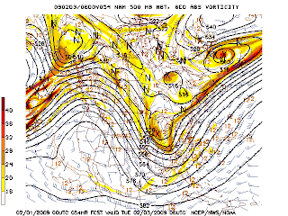
Okay, so there's the latest model runs, if you want snow hope for track like the NGM is showing, if you don't want much hope for the GFS. The upper air charts for the NAM and GFS are looking better for a storm that would bring more impact to KY, they hold the 500mb vorticity *Which is spin in the atmosphere* back over KY in the trough. The NGM does as well, but to a lesser Extent.
500 MB GFS


500 MB NAM


500 MB NGM

These charts would suggest the surface precip, might be to far to the east as they will want to be close to where all the energy *Spin* is.
Now just to round out the anaylsis, here's some Jet stream for ya.
GFS


NAM


NGM

The interesting thing of note here is all 3 models are showing phasing of the jets, or where they come together over east Georgia and Southern SC, or just off the coast of those states. Where the jets come together, you get intense cyclogenesis, which is weather man spaek for rapid formation and intensification of a low pressure system. If this were to happen over say Northern Gerogia, or western SC, then KY would be in the big time zone. At this point folks, I'm not exactly sure how much snow we're going to see. It's all going to depend on how the track continues to develop through the next 48 hours. I would say folks between I-65, and I-75, can expect less than 4 inches from this sytem. People west of there see little to nothing, People between I-75 and the WV/VA boarder see 3-7 inches *higher totals possible in the mountains.* People in WV see generally 6"+ from this thing. Okay, I'll make a quick map to illustrate.

This is assuming the low tracks somewhere between the path of the NGM, and the path of the NAM. If it takes the NGM's track, we see more snow, if it takes the NAM's path, we see less snow, if it takes the current GFS's path... what snow?
So there you have it folks, you want snow hope for a westward track, you want no snow hope for an easterly track, it's as simple as that. Hope you have a great time enjoying the Superbowl while I'm working :P, I'll be back with another update possibly tomorrow morning, or definitely after the big game.


2 comments:
I hope we get a lot of snow in Williamsburg, Ky! We got completely skipped by last week's storm!
thanks for your work Shane
And Knox has been skipped on every snow thats came across
Andy
Post a Comment